Laser Tracker Volumetric Error Mapping Mechanics during Precision Tool Transfer
Precision tool transfer requires distributed atmospheric compensation and multi-station laser tracker network bundling to prevent structural drift errors.

Refraction
Laser tracker distance measurement relies on light passing through ambient factory air, where changes in air density shift the speed of light. Precision requires stable air. In large metrology environments ~ like aerospace assembly bays or automotive stamping plants ~ factory air is rarely uniform.
Temperature gradients, pressure shifts, and humidity variations alter the refractive index along the optical path, bending the beam and changing phase velocity. Absolute distance meters measuring time-of-flight or phase shift assume a fixed group refractive index. If atmospheric compensation algorithms receive bad temperature data from unrepresentative ambient sensors, those errors carry straight into the final spatial point coordinates.
The modified Edlén equation defines how atmospheric conditions set the refractive index of air. At standard wavelengths ~ 632.8 nanometers for helium-neon interferometers or 1550 nanometers for absolute distance meters ~ a one degree Celsius shift in temperature causes roughly a one part-per-million offset in distance. A pressure change of 2.5 millimeters of mercury or 3.3 millibars produces the same one part-per-million error.
Over a 15-meter range, an uncompensated three-degree Celsius ambient gradient creates a 45-micrometer spatial shift on a single vector. In precision tooling transfers, where total allowable drift across a six-meter fixture might be under 50 micrometers, refractive drift can burn through the whole error budget before anyone even inspects the tool itself.
An uncompensated ambient air temperature gradient of 2.8 degrees Celsius across a 12-meter measurement beam path induces a spatial position error of 34.2 micrometers in laser absolute distance meter readings.
Thermal stratification in high-bay facilities produces steep vertical gradients. Warm air gathers near the ceiling in distinct temperature layers that refract horizontal laser beams downward. Radial gradients also form near exterior walls, HVAC vents, and heavy machinery.
When a tracker targets points spanning from floor level up to top tooling risers, the beam cuts across these uneven thermal zones. A single sensor mounted on the tracker body cannot pick up these microclimates; capturing them requires multi-sensor arrays placed along the path to measure local air temperatures and apply distributed refractive index corrections across the model.
Atmospheric Compensation Parameters across Industrial Bay Microclimates
Placing distributed weather stations along the measurement volume helps control refractive beam bending. Barometric pressure stays fairly uniform across an open floor, but local temperatures swing sharply near heat sources. Relative humidity has a smaller effect in the visible and near-infrared spectrum, though extreme shifts still alter the refractive index enough to throw off long-range coordinates.
High-precision transfers require continuous logging of environmental conditions throughout baseline data collection, establishing a clear record for uncertainty calculations.
| Variable Parameter | Nominal Baseline | Delta Unit Shift | Refractive Index Delta (ppm) | Distance Offset at 15 Meters (mm) |
|---|---|---|---|---|
| Air Temperature | 20.0 °C | +1.0 °C | -0.93 ppm | -0.014 mm |
| Barometric Pressure | 1013.25 mbar | +1.0 mbar | +0.27 ppm | +0.004 mm |
| Relative Humidity | 50.0 % RH | +10.0 % RH | -0.04 ppm | -0.001 mm |
| Carbon Dioxide Level | 450 ppm | +100 ppm | +0.01 ppm | +0.0001 mm |
As beam deflection corrupts measurement data, a laser passing through turbulent thermal boundaries experiences high-frequency refraction that causes the spot to wander across the target reflector. The tracker’s steering system tries to hunt this optical noise, which introduces encoder errors. Shielding long beam paths with physical tubes or running high-volume mixing fans breaks up these sharp thermal boundaries, turning steep gradients into a more uniform environment that the Edlén equation can handle properly.

Wavelength Shift and Absolute Distance Meter Errors
Absolute distance meters calculate target position by modulating optical signals or using frequency combs. The internal frequency standard depends on a stable diode laser or gas-cell lock. Operating the instrument before it reaches thermal equilibrium shifts its emission wavelength, causing scale calibration drift.
Giving the unit a 30- to 45-minute warm-up period stabilizes internal laser cavities before baseline coordinates are recorded for precision transfers.
Interferometers track relative displacement from a known reference point by counting standing wave fringes. If the beam breaks, the instrument drops back to its absolute distance meter, which introduces a small reset uncertainty. Current absolute distance meters match interferometers within five micrometers over a ten-meter distance.
Relying on both modes requires periodic baseline checks against a calibrated carbon-fiber reference bar inside the shop environment.
Spherically Mounted Reflector Optical Center Distortions
Spherically Mounted Reflectors seat a corner-cube glass prism inside a hardened steel sphere. Ideally, the optical apex of the prism sits at the exact geometric center of the sphere, but thermal stress and manufacturing tolerances introduce small offsets between the glass vertex and the steel shell center ~ a deviation known as SMR runout or centering error.
High-accuracy tool transfers require open-air corner-cube reflectors or high-precision glass SMRs with certified centering runout under 0.0025 millimeters. Standard-grade targets can have runout exceeding 0.012 millimeters. Rotating an SMR in its magnetic nest during a measurement shifts that optical center relative to the nest, introducing artificial coordinate errors.
Calibration records should log specific optical offsets for each SMR serial number in use.
Ignoring thermal gradients during baseline metrology ruins downstream tool repeatability, leading to unbudgeted re-alignment cycles that can cost up to $45,000 per fixture move.

Gimbal
Dual-axis rotating heads introduce encoder eccentricity and beam steering errors during large-volume scans. A laser tracker’s mechanical axes ~ azimuth and elevation ~ rotate on precision bearings to point the beam at target reflectors, while internal shaft encoders digitize those angles. Imperfections in bearing seats, axis non-perpendicularity, beam offset from the axis intersection, and tilt sensor zero drift all generate systematic volumetric errors.
Mapping these mechanical flaws is what turns raw angle-and-range data into traceable 3D coordinates.
Volumetric error mapping models the measurement volume using vector error fields. Angular errors grow linearly with distance: at a 10-meter radius, an encoder alignment error of two arcseconds creates a 9.7-micrometer tangential displacement. Combining azimuth eccentricity, elevation axis tilt, and optical collimation errors creates a complex distortion map across the instrument’s spherical coordinate system.
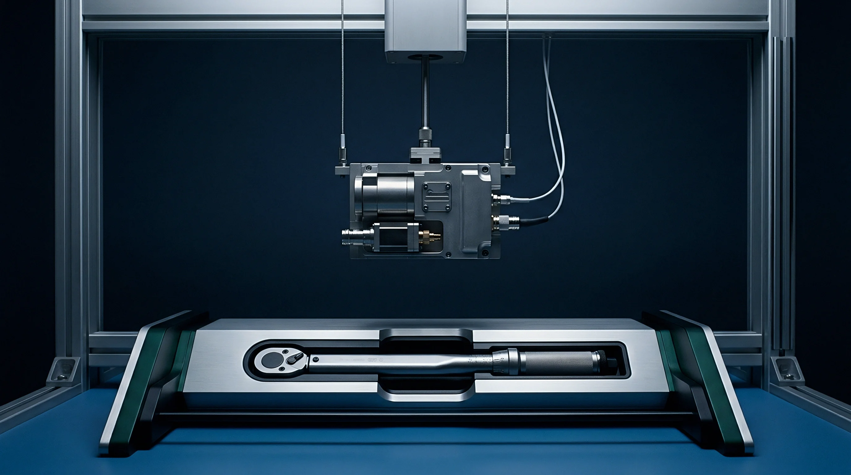
Geometric Axis Misalignments and Encoder Scale Residuals
Encoders carry microscopic geometric flaws. Axis non-perpendicularity occurs when the elevation axis misses a true 90-degree angle to the azimuth axis. Collimation error happens when the optical beam isn’t strictly perpendicular to the elevation tilt axis.
Transit offset is the physical distance separating the azimuth axis from the elevation axis. Calibration software models these parameters through transformation equations, applying real-time corrections to raw encoder outputs.
| Error Component | Kinematic Representation | Diagnostic Verification Method | Typical Magnitude Range |
|---|---|---|---|
| Azimuth Axis Wobble | Periodic pitch/roll tilt vs angle | Precision electronic level rotation | 0.5 to 2.0 arcseconds |
| Elevation Axis Tilt | Non-perpendicularity to azimuth | Two-face backsight point measurement | 1.0 to 4.0 arcseconds |
| Optical Collimation Error | Beam misalignment to tilt axis | Infinitely distant target backsighting | 2.0 to 8.0 arcseconds |
| Transit Offset Distance | Horizontal separation between axes | Radial range reversal scan | 0.001 to 0.005 mm |
Two-face measurements isolate internal mechanical axis errors. Measuring a fixed point in front-face mode, then rotating the gimbal head 180 degrees in azimuth and flipping elevation to acquire the same target in reverse-face mode exposes collimation and transit errors. Subtracting front-face vectors from reverse-face vectors separates internal geometric offsets from actual environmental or target movement.
Compliance with ISO 10360-10 Clause 6.2 demands two-point length measurement tests under active temperature tracking, rejecting coordinate datasets captured when ambient drift exceeds 0.5 degrees Celsius per hour.

Multi Station Metrology Bundling with Unified Networks
Moving large tooling structures between plants usually involves measurement points outside the line of sight of a single tracker position. Using multiple instrument setups creates a unified spatial network. These networks bundle measurement vectors from several tracker stations into a single global solver, calculating point coordinates and tracker positions at the same time.
Evaluating spatial measurement networks across 20-meter airframe jigs shows single-station uncertainties multiplying at outer tooling features. Moving the tracker around the fixture perimeter creates overlapping sightlines to shared reference points. Mathematical bundling algorithms apply weighted least-squares optimizations ~ accounting for individual distance and angle sensor uncertainties ~ to generate volumetric covariance ellipses for each measured target.
Optimized network setups require sightlines that intersect at wide angles. Oblique vector intersections eliminate weak measurement directions, constraining the uncertainty volume. Weak geometry happens when trackers line up in a straight line, stretching radial position uncertainty into elongated error ellipsoids along the main lines of sight.
- Uncompensated Beam Steering Deflections occur when dynamic tracking mirrors flex under rapid angular acceleration during high-speed tooling scans.
- Thermal Expansion of Gimbal Housings shifts internal optical beam intersections away from encoder rotational nodes, altering mechanical zero calibration constants during shop floor temperature transitions.
- Encoder Periodic Linearity Deviations inject cyclic spatial position ripple along specific angular sectors during circular measurement sweeps around round fixtures.
- Gravity Dependent Axis Deflection causes minute structural bending of the tracker elevation fork when pointing the optical head toward high zenith angles.

Where Does Volumetric Drift Break Tooling Acceptance?
ASME B89.4.19 and ISO 10360-10 set standard verification procedures for laser trackers. ISO 10360-10 evaluates volumetric performance by measuring calibrated length standards across multiple orientations in the working volume. Comparing measured scale distances against traceable reference lengths reveals instrument error limits.
Precision tool transfer specs mandate running field performance checks before establishing baseline point clouds.
In scope audits of precision tooling transfers, failing to run field verification tests before logging baselines routinely hides damage sustained during equipment transit. Transport shocks can shift mirror alignments or damage spindle bearings. Field scale bars ~ made from zero-expansion Invar steel or carbon-fiber composites ~ confirm that the instrument meets manufacturer accuracy bands before critical data collection starts.
Whether spatial network covariance matrix estimates accurately capture structural micro-straining during transit remains an open question in high-precision airframe tooling transfers.


Flexure
Large aerospace assembly fixtures undergo elastic deformation when unbolted from floor plates and loaded onto transport frames. Frame geometry shifts under its own weight. Steel and aluminum structures show complex compliance, bending under local gravity vectors, crane rigging loads, and transit vibration.
Transferring precision tooling requires separating coordinate shifts caused by dynamic mechanical deformation from actual physical damage or locator pin wear.
Airframe fixtures bend under gravity, as structures designed for static shop-floor mounting relax internal stress once anchor bolts are released. Floor stiffness also varies across bays: an eight-inch concrete slab deforms differently under a twelve-ton tool than a twenty-four-inch reinforced pad. Moving a tool to a new building shifts relative pin, bushing, and clamp positions simply through differences in floor compliance.
Tooling frames locked to concrete floors with rigid anchors exhibit higher baseline stress accumulation than fixtures isolated on kinematic point mounts.
Kinematic mounts isolate tooling structures from floor movement. A standard three-point mount with cup, groove, and flat interfaces constrains six rigid-body degrees of freedom without introducing internal bending moments. Oversized weldments without kinematic support rely on multi-point leveling jacks instead.
Adjusting those jacks without spatial feedback twists the chassis, driving critical details out of geometric product specification tolerances.
Gravitational Sag and Base Kinematic Support Shifts
Finite element modeling predicts gravity sag profiles across transport phases. Baseline laser tracker surveys record target grids while the fixture is still installed at the origin site with floor anchors fully torqued. Re-surveying the fixture unbolted and free-standing reveals internal residual stress relief, which alters baseline point groups.
- Mount precision laser targets on key structural nodes and critical locator bushings across the unbolted tool assembly at the origin site.
- Execute a multi-station unified laser tracker network survey to record the stress-free baseline spatial coordinates under controlled bay ambient conditions.
- Secure the tool to transport frames using approved tie-down locations matched to finite element low-stress support nodes.
- Transport the fixture to the destination facility, monitoring three-axis acceleration logs to verify shock inputs remain below contract thresholds.
- Position the tool on destination floor plates, utilizing spherical kinematic jack stands to replicate original vertical support heights without torquing floor bolts.
- Perform an initial laser tracker survey to calculate point vector shifts against the unbolted baseline measurement dataset before executing final floor anchor grouting.
Comparing post-transport coordinate maps against origin baselines generates spatial delta vectors for each reference target, revealing structural movement. Rigid-body transformations, like Best-Fit algorithms using Singular Value Decomposition, separate overall translation and rotation from internal frame deformation. If residual vectors stay within tolerance after alignment, the tool survived transit intact.
Thermal Expansion Co-Efficients and Frame Strain
Assemblies made from mixed materials undergo internal thermal strain when temperatures shift. Carbon steel frames with aluminum alignment plates experience differential expansion: steel has a thermal expansion coefficient of roughly 11.5 microstrain per degree Celsius, while aluminum expands at 23.0 microstrain per degree Celsius. Across an eight-degree Celsius temperature shift, a four-meter aluminum rail mounted on a steel frame expands by 0.368 millimeters more than the base beneath it.
Metrology software can scale for uniform thermal expansion if material temperatures and coefficients are correctly entered. Otherwise, uncompensated expansion introduces artificial distortion into tracker point clouds. Magnetic temperature sensors on steel and aluminum elements stream live data to the software, scaling target coordinates back to standard 20-degree Celsius reference values before computing deformation matrices.
Measured vector shifts can stem from foundation settling in the new bay rather than structural deformation during transit.


Handover
Transferring manufacturing tooling between plants requires complete digital metrology documentation to maintain coordinate integrity. Handing over only final transformed coordinates strips integration engineers of the raw measurement vectors needed to re-evaluate network calculations or audit environmental models, whereas complete raw data prevents alignment disputes. A proper transfer package must include unmanipulated sensor readings, calibration certificates, atmospheric logs, and native metrology project files.
Native project files from platforms like SpatialAnalyzer or PolyWorks capture the complete network history. These archives preserve tracker positions, target weights, instrument setups, temperature readings, and optimization constraints. Keeping raw measurement histories allows integrators to re-bundle spatial networks with updated target offsets or different transformation criteria without having to re-measure the physical tool.

Metrology Dataset Formats and Native Project Archives
Compatibility issues often surface when moving project archives between different software platforms or versions. ASCII point clouds containing raw Cartesian coordinates transfer point locations without loss, but drop instrument metadata, target names, uncertainties, and sightlines. Neutral exchange standards like IPC-2581 or STEP AP242 metrology schemas preserve attributes, geometric tolerances, and coordinate frames across different software platforms.
| Deliverable Component | File Extension / Format | Required Data Content | Acceptance Verification Method |
|---|---|---|---|
| Native Project Archive | .SA /.PWK /.IGS | Full measurement tree, raw instrument setups, target observations | Project open check, re-bundle recalculation hash match |
| Raw Coordinate ASCII | .CSV /.TXT (Comma Delimited) | Point ID, X, Y, Z, SMR Serial, Temperature, Timestamp | Checksum verification, schema validation scan |
| Target Calibration Log | .PDF /.XML | SMR serial numbers, optical center runout, sphere diameter offsets | Serial number physical audit against target kit |
| Environmental Logs | .CSV / Log File | Continuous time-series pressure, humidity, air/structure temperatures | Time-stamp synchronization against metrology events |
| CAD Reference Model | .STEP /.IGES /.CATPart | Nominal CAD geometry, master coordinate system, reference datum targets | Hash comparison against engineering baseline CAD |
Alignment parameters must link physical measurement points directly back to master assembly CAD models so that digital models define spatial truth. Establishing primary, secondary, and tertiary datums on the tool structure defines its local coordinate system. Transfer packages require clear documentation showing how measured reference nests map to CAD coordinates, preventing origin mismatches during plant bring-up.
Point transformation matrices derived without explicit temperature logs mask structural distortion under mathematically valid rigid-body fits.
SMR Calibration Dossiers and Target Offset Tracking
Precision target tracking requires detailed records for every reflector used across both origin and destination surveys. Target reflectors suffer wear in the field ~ dropping an SMR can fracture glass or distort the shell, shifting the optical center away from the sphere center. Calibration dossiers must list tested sphere diameters, optical offsets, and form errors for every reflector in the kit.
Transfer contracts specify raw interferometer counts alongside transformed coordinates. Target radius calibration values must be applied correctly in the software: measuring a cylindrical locator bushing with an SMR requires subtracting the exact calibrated radius from center coordinates along the normal surface vector. Using nominal radius values instead of calibrated numbers introduces systematic offsets up to 0.015 millimeters on critical locator surfaces.

Coordinate System Definition and Alignment File Transfer
Transforming datasets between coordinate systems relies on reference point groups mapped across common fixture features. Alignment algorithms calculate rotation and translation matrices to align point clouds with CAD models or secondary stations. Implementing multi-station bundling protocols drops spatial drift from 85 micrometers down to 18 micrometers.
- Master Datum Point Nest Coordinates define the baseline physical origin, orientation axes, and alignment reference points permanently attached to the tool frame.
- Transformation Matrix Coefficient Records store explicit 4×4 matrix values used to translate and rotate raw measurement coordinates into CAD reference frames.
- Residual Vector Deviation Reports list individual point fitting errors post-alignment, highlighting local mechanical deformation zones on the tool frame.
- Instrument Field Verification Logs document pre-test and post-test scale bar checks, validating tracker accuracy parameters during data collection windows.
Incorporating ASME Y14.41-2019 Clause 4.3 into the transfer contract locks coordinate system definitions to digital CAD models, preventing suppliers from handing over transformed point clouds in place of raw sensor logs.


Settlement
Tooling relocation contracts need explicit financial boundaries around post-transport measurement and alignment work, using clear scope definitions to fix financial liability. Disputes pop up when relocated tools fail final product validation at the new plant, leaving integrators and vendors arguing whether errors stem from transit damage, bad floor anchoring, missed baseline mapping, or atmospheric shifts in the new bay. Detailed statements of work eliminate this by defining exact metrology deliverables, engineering costs, and acceptance criteria upfront.
Re-alignment costs scale directly with volumetric error. Contracting laser tracker metrology requires choosing the right integration tier. A turnkey scope places full commercial liability on the vendor to deliver an aligned, verified tool producing conforming parts at the destination.
A semi-custom scope splits risk, charging the buyer for baseline mapping while the vendor handles physical positioning. Setting explicit scope boundaries prevents unbudgeted change orders during tool bring-up.

Non Recurring Engineering Pricing for Volumetric Mapping
Non-recurring engineering fees for volumetric mapping reflect labor hours, equipment usage, and processing complexity. High-precision mapping requires multi-station tracker networks, environmental sensor arrays, and finite element stress checks. Pricing models should separate basic point verification from comprehensive volumetric error mapping and structural fit analysis.
| Integration Scope Level | NRE Engineering Hours | Data Deliverables Scope | Re-Alignment Liability Ownership | Average Scope NRE Cost Range |
|---|---|---|---|---|
| Basic Point Verification | 16 to 24 Hours | Single-station point cloud, simple ASCII delta report | Buyer retains full alignment risk | $3,500 ~ $6,000 |
| Semi-Custom Mapping | 40 to 60 Hours | Multi-station network file, rigid-body fit vectors, thermal logs | Shared risk based on tolerance delta thresholds | $10,000 ~ $16,000 |
| Turnkey Volumetric Guarantee | 80 to 120 Hours | Full USMN bundle dataset, deformation modeling, part run verification | Vendor holds complete alignment liability to buy-off | $22,000 ~ $38,000 |
Engineering line items must spell out deliverable formats, acceptance thresholds, and measurement conditions. Quotes that specify generic inspection services leave room for vendors to run basic single-station point checks, shifting hidden re-alignment costs back to the buyer when unmapped volumetric errors prevent proper setup.

Commercial Risk Allocation across Metrology Milestones
Structuring milestone payments around metrology sign-offs ensures compliance before funds release. A typical schedule allocates 30 percent to baseline acceptance at the origin facility, 30 percent to unbolted verification upon arrival, 30 percent to final anchored alignment buy-off, and 10 percent to initial production part validation. Withholding final payment until part scans confirm geometric conformance keeps vendors aligned with compliance goals.
Transfer contracts must define precise numerical thresholds for point vector residuals. Setting a maximum spatial vector delta ~ such as 0.050 millimeters across primary locator nests ~ gives an objective cutoff for acceptance. If destination surveys show vector shifts beyond that limit, responsibility for adjustment and re-mapping falls to whichever party is assigned risk in the contract matrix.

Dispute Resolution for Point Vector Deviations
Resolving metrology disputes between buyers, carriers, and integration engineers requires clear arbitration rules. Statements of work should name an independent metrology provider to run audit scans with calibrated equipment if vector discrepancies crop up. Costs for the audit fall on whichever party’s dataset proves inaccurate during cross-verification.
Data provenance logs quickly resolve technical arguments over setup or atmospheric conditions. Continuous temperature, pressure, and humidity records paired with self-calibration logs prove whether baseline conditions met ISO 10360-10 standards. Requiring these metrology submissions shrinks dispute timelines from months to days, keeping bring-up schedules on track.
When point group residual vectors exceed origin acceptance limits, financial liability shifts to the transport carrier.